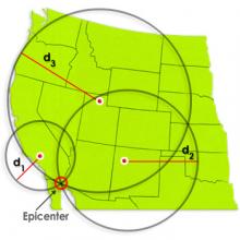
Identify the location of an earthquake epicenter using a travel time graph and three seismograph tracings. The epicenter is the point on Earth's surface directly above an earthquake. Seismic stations detect earthquakes by the tracings made on seismographs. Tracings made at three separate seismic stations are needed to locate an earthquake epicenter.
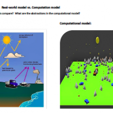
This is an example of how a computer modeler uses various aspect of computational thinking while designing, creating and using a computer model as a tool to think with.
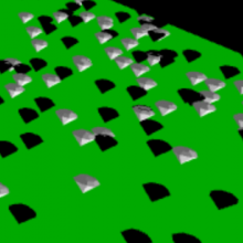
A model demonstrating the albedo effect of black or white surfaces. Use as a part of the Climate Change and Agriculture Project GUTS Curricular Unit, or as a stand-alone model, activity, and video.